Driving the Kancamagus Highway in Winter
Long admired for its beauty in the summer and fall, the Kancamagus Highway in the White Mountains of New Hampshire can be equally beautiful in the winter.
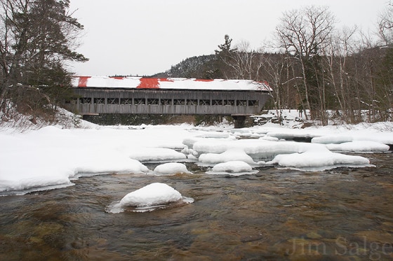
Albany Covered Bridge
Photo Credit : Jim SalgeThe Kancamagus Highway in the White Mountains of New Hampshire is famed for its striking scenery, impressive elevation, and endless views. The east-west road winds its way from Conway to Lincoln along rivers, up valleys and over the highest paved point on a through-road in the state.
The Kanc, as its locally known, is very popular in the summer, with numerous swimming holes, waterfalls, hiking trails and campgrounds along the marathon-lengthed highway. Its fame, though, is garnered from the autumn colors which concentrate along the corridor, and visitors come from all over the world to leaf-peep along the route.
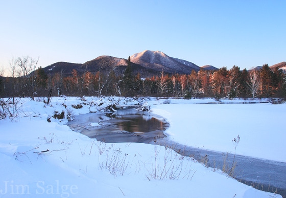
Photo Credit : Jim Salge
I vividly remember my first trip across the Kancamagus Highway shortly after moving to New Hampshire. It wasn’t in summer or autumn, though I’ve since spent a great deal of time exploring its length during those seasons as well. It was spring, on a warm day in mid-May, right in the heart of the unheralded season of mud and bugs, and even though flowers were in bloom at low elevations, I was amazed to find an impressive pack of snow at the 2850 ft Kancamagus Pass. For someone in the process of moving up from New Jersey, this was quite the novelty.
The Kancamagus Highway receives a lot of snow each year. The first snowfall usually occurs before the leaves have fully fallen, and the last snowfall may not occur until Memorial Day. Winter is long along this road, but it is well maintained, and opportunities for winter recreation abound for cross country skiers, snowshoers, hikers, photographers, as well as the casual visitor.
A recommended first stop on your journey across the Kanc in winter is the US Forest Service Ranger station just west of the town of Conway, where you can get information on the latest conditions along the road, as well as maps highlighting the many sites to explore on your journey.
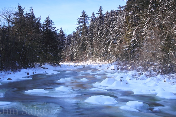
From there, heading west, the first stretch of the Kanc is low and level and follows the boulder-strewn Swift River, choked with green and blue ice. After a few miles, you come to the first must-see site at the Albany Covered Bridge. In all other seasons, the bridge is open for traffic, allowing travelers to connect to the Passaconaway Road, which would take you back east to North Conway. In winter though, the road is closed and the bridge is gated to cars, leaving it snow-covered and quintessentially quaint.

Across the bridge lies the eastern terminus of the Nanomocomuck Cross Country Ski Trail, which follows the Swift River upstream on the opposite bank of the Kanc for seven miles to Bear Notch Road. The trail is quite popular, easy to follow and well tracked out by skiers and snowshoers there to take in the fantastic views of the mountains over the river.
There are many other great places to strap on the snowshoes and cross country skis before the road begins to climb in elevation at around the halfway point. Another scenic and popular ski trail loops from the Oliverian Brook Trailhead, and at scenic Rocky Gorge, you can find another access to the Nanomocomuck.
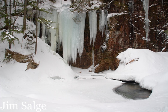
Other areas to explore on the eastern Kanc include Lower Falls, a popular summer swimming hole that offers amazing opportunities for icy roadside exploration in winter, and further west, at the Sabbaday Trailhead begins an easy one mile round trip trek to a short gorge, beautiful blue pool, and unbelievable ice formations. And for those looking for a real challenge and a full day’s hike, the Champney Falls Trail will take you all the way to the top of popular Mount Chocorua.
Just beyond the entrance to Sabbaday Falls, the highway begins to climb in elevation and the views from the road become more distant. Not all of the overlooks are plowed in winter, and that may be just as well. The weather at the pass is often blustery, even on the calmest days at lower elevations, and snow showers can develop even on sunny days in the valleys.
The trip down from the pass puts you in the heart of a rugged area of the White Mountains, as high peaks tower above the winding road for a few miles back down to the level. Just before the Kanc leaves the National Forest, the large, Lincoln-Woods Trailhead, just outside of the town of Lincoln allows access to much of this great wilderness surrounding you.
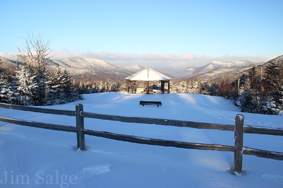
The trip across the Kancamagus Highway in winter can take as little as 45 minutes, or you could spend a whole day exploring its hidden treasures. The trailheads along the highway offer access to hundreds of miles of hiking, snowshoeing and cross-country ski trails that take you to viewpoints and waterfalls. There are opportunities for activities for anyone willing to brave a winter day to explore.
But my favorite part about the Kanc?
Ending in either the towns of Conway and Lincoln or North Conway and North Woodstock and enjoying the charms of these mountain towns after a wonderful day in the New England wilderness!
Have you ever driven the Kancamagus Highway? How about in winter?
This post was first published in 2013 and has been updated.
SEE MORE:
How the Kancamagus Highway Got Its Name and How to Pronounce It
The Kancamagus Highway | The Ultimate New Hampshire Fall Foliage Drive
Best of the New Hampshire White Mountains | Editors’ Choice Awards
Jim Salge
As a former meteorologist at the Mount Washington Observatory, foliage reporter Jim Salge is a keen observer of the progression of the seasons in New England. He uses his knowledge of weather, geography and climate to pinpoint the best time to visit various New England locations to find the best light, atmosphere, and most importantly, color.
More by Jim Salge

