


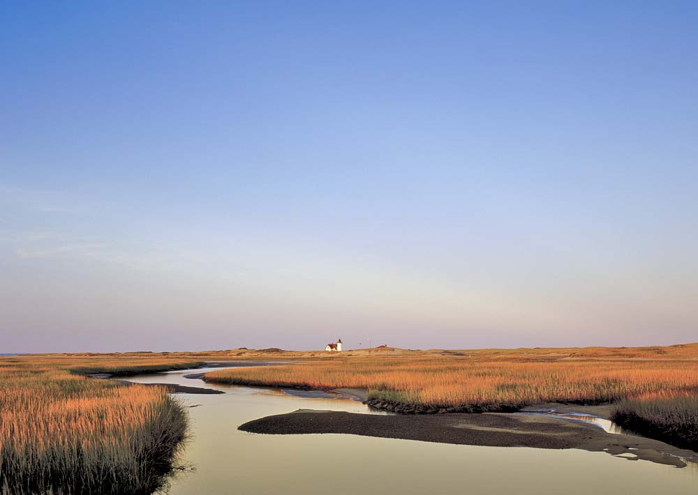
Hatches Harbor
Take Route 6 all the way out through Provincetown, into Cape Cod National Seashore. Just past the parking area for Herring Cove Beach, you’ll find a small sand lot, where you can park. (If you have trouble finding it, go to the ranger booth at Race Point and they’ll give you directions.) The sign across […]
By Jennifer Kain Defoe|Feb 21 2008|![]()
Coffee By Design | Portland, Maine
Photo Credit : Katherine KeenanTake Route 6 all the way out through Provincetown, into Cape Cod National Seashore. Just past the parking area for Herring Cove Beach, you’ll find a small sand lot, where you can park. (If you have trouble finding it, go to the ranger booth at Race Point and they’ll give you directions.) The sign across the dirt track here says “Fire Road” (one of many throughout the Seashore), but it’s okay to walk it. This trek to Hatches Harbor, on well-packed sand and dirt, winds through a massive salt marsh. Views of Cape Cod Bay and Race Point Lighthouse are to the left. Views of a historic Coast Guard station and the Old Harbor Lifesaving Station are to the right. Pilgrim Monument is behind you. After about a mile, you’ll come to water at high tide or flats at low tide. The flats aren’t muddy during low tide (and you can walk out to Race Point Light). If the tide should come in while you’re out there, there’s a road that’s used by oversand vehicles that’s accessible at all times. I didn’t see a single person during my walk. The total distance was about 3-1/2 miles.


This is a stunning photo of the salt marshes on the way to Hatches Harbor. I’m going to take this walk as soon as possible! Thanks very much.