New Hampshire
Alternative Route around North Conway
Photo Treasures on the Road Less Traveled You might ask how taking the road less traveled will increase your fall foliage enjoyment. Let’s say you’ve planned out your route and you are heading into New Hampshire’s White Mountains via route 16 from the south. Well-known destinations on this route include the beginning of scenic Kancamagus […]
Photo Treasures on the Road Less Traveled
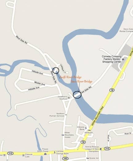
You might ask how taking the road less traveled will increase your fall foliage enjoyment. Let’s say you’ve planned out your route and you are heading into New Hampshire’s White Mountains via route 16 from the south. Well-known destinations on this route include the beginning of scenic Kancamagus Highway (route 112), the outlet shopping mecca of North Conway, and the Conway Scenic Railway. In foliage season these are well traveled to the point of crowded. Here is an alternative route, with photo opportunities that those who stick to main roads often miss.
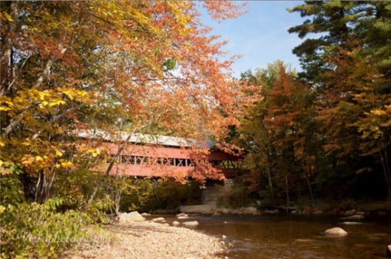
Covered Bridges
The first is just a few hundred yards up this road — the Saco River Bridge, one of Conway’s two covered bridges. The Saco River Bridge is on the right at the triangle of the small park where East Side Road and West Side Road diverge. There’s a small parking lot, also a sidewalk on one side of the structure. We’ve been stalking this for many years looking for just the right light for photographs. We think it’s early in the day, so the big maple tree to the right is backlit with early morning light. Watch for traffic at any time of day.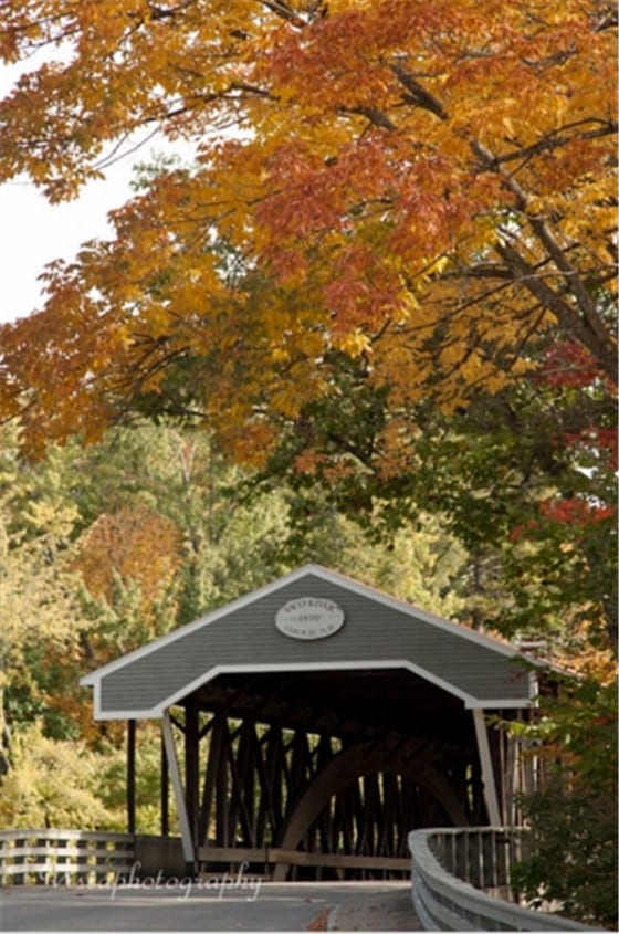
Cathedral Ledge and Diana’s Baths
Now we will continue to travel north a short ways and if you keep your eyes open you should see Cathedral Ledge looming on your left and the turn into the state park will be just after that. The nice part here is that you can drive up to the top. Within 4-5 minutes you will find parking around the loop at the top. From there you find several paths to take you out onto the edge of Cathedral ledge. Most of it has been fenced off so kids should be safe, but be warned that there are a few areas without fencing so climbers can traverse the face of the hill. On a clear day you can see well up into Pinkham Notch and if the area is near peak the valley around the foot of the ledge will be a tapestry of reds and golds. After exploring up here you can head back to the car and the short drive back down the hill. Once back onto West Side Road, take a left and head north again. Just up the road, again on the left, will be signs for Diana’s Baths, a series of cascading waterfalls. Each stair step of falls flows down into holes and depressions in the rock that then flow into the next level below. During the summer people come here to wade and swim in the pools formed by the water wearing away at the granite. But at this time of year, leaf peepers come here for the falls and the reflections of the surrounding autumn colors. We continued up to the falls and found several red and gold maples to use in framing photos of the falls. This is a very easy walk into the falls and even if you have kids and a stroller you shouldn’t have too much trouble. Once at the falls there are roots and rocks to navigate, so that might give you a slight workout. We soon headed down the path to the parking lot and car. On the road again, West Side Road meets back up with route 16 and, in skipping the shopping route, we found two covered bridges and two attractions that are wonderful to visit at any time of the year but especially during the fall foliage season.