Hiking Mount Katahdin and the Infamous Knife Edge Trail in Maine
The wild Knife Edge Trail on Mount Katahdin draws adventurous hikers from all over to Maine’s highest mountain.

The Knife Edge Trail on Mount Katahdin.
Photo Credit : Cathryn McCannPeople from near and far have heard of Mount Washington — the highest point in the Northeast, some of the strongest winds in the world, and mountain views that can leave even the staunchest of hiking skeptics breathless. But one state over and roughly 200 miles away, there stands a mountain that draws adventurers from all over to the rural back roads of Maine, the lush forests of Baxter State Park, and trails that are more like a game of rocky hopscotch. It’s a mountain that has been standing tall for over 400 million years, shaped and sculpted by glaciers, and whose Penobscot name means “greatest mountain.” It’s Mount Katahdin, the centerpiece of 235,000-acre Baxter State Park in north-central Maine and, as the highest mountain in the state (5,267 feet), one of the great pinnacles of New England hiking.
Mount Katahdin and the Knife Edge Trail
The beauty of Katahdin does, of course, make it a very popular destination. If you’re hiking for the day and not staying at the park overnight, there are multiple trailheads at which to park and begin the hike, all of which require online reservations (parking areas are capped at a certain number of vehicles). Maine residents can reserve a spot anytime after April 1; nonresidents up to two weeks before the hike. Each reservation must be presented at the entrance gate on the morning of your hike. Reservations are held until only 7 a.m., so plan on arriving early and waiting in a line of cars during peak season.
Not sure where to reserve a spot? It all depends on which hiking route you plan to take. You can access the Helon Taylor and Chimney Pond trails from the Roaring Brook Campground, the Abol Trail from the Abol Campground, and the Hunt Trail from the Katahdin Stream Campground.
Our route: Roaring Brook Campground parking, up the Helon Taylor Trail to Pamola Peak, across Knife Edge Trail to Baxter Peak, down Saddle Trail to Chimney Pond Trail and back to the parking area. Four trails, nine miles, two peaks.

Photo Credit : Cathryn McCann
The Helon Taylor Trail (blue blazes) starts out as a classic moderate trail with several areas of climbing. Once you break the tree line, however, it quickly becomes very rocky, requiring careful footing and some hands-and-knees scrambling. The 3.2-mile trail with 3,413 feet of elevation gain is rated as “very strenuous,” and it should not to be attempted in bad weather due to its level of exposure.
After a steep climb up sometimes-loose rocks and boulders, the Helon Taylor Trail eventually leads to Pamola Peak, the first peak before you head across the Knife Edge Trail to the summit of Katahdin.
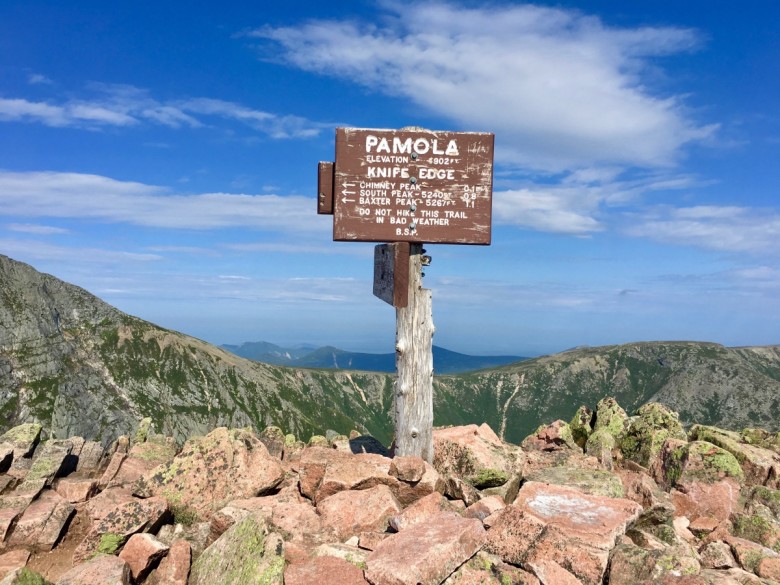
Photo Credit : Cathryn McCann
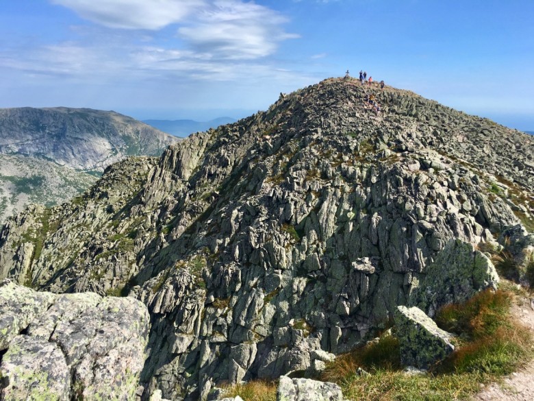
Although only 1.1 miles in length with an elevation gain of 365 feet, the Knife Edge Trail is a very technical hike in fully exposed conditions. Hikers are advised not to leave the ridge once they’ve started, and to traverse it in only one direction (due to its level of difficulty and the length of time it takes one-way). From Pamola Peak, the hike begins with a steep descent down jagged boulders, followed by an equally steep ascent — more of a tactical climb than hiking, really — before flattening out into a narrow, rolling ridge of rocks.
The traverse across Knife Edge is relatively tough and requires focus and agility. Some spots are as narrow as four feet, with 2,000-foot drops on either side. Proper equipment, weather preparedness, and good decision-making are necessities.
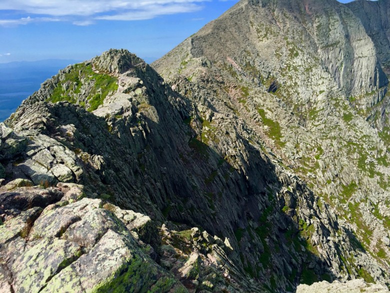
Photo Credit : Cathryn McCann
If you’re prepared and careful, however, the 360-degree view of the incredible rocky trail and inner basin are sights worth seeing.
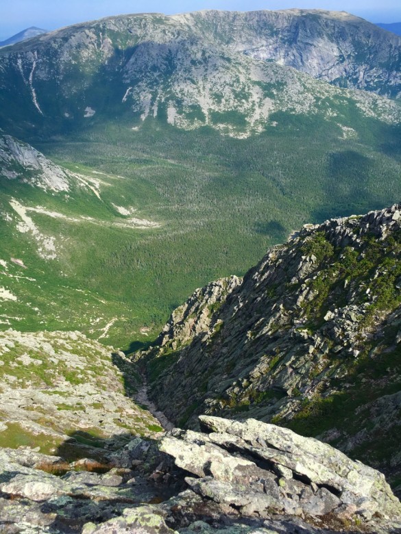
Photo Credit : Cathryn McCann
Inching across a mile of loose boulders in pursuit of a beautiful summit is an experience worth having.
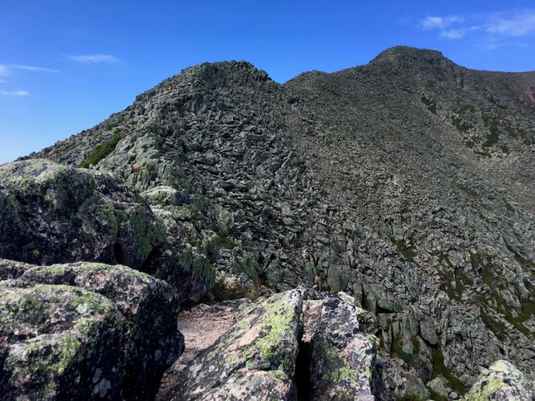
Photo Credit : Cathryn McCann
And making it across, being able to look back at what you just did and at the seemingly tiny world below, is a feeling worth having.
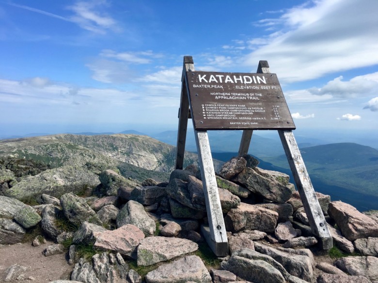
Depending on the season and time of day, there can be quite a crowd at the summit of Mount Katahdin, all eager to take photos with the 5,267-foot summit sign. It’s possible you’ll even meet folks completing the incredible 2,200-mile Appalachian Trail thru-hike, as Mount Katahdin is the final destination on that route after the Hundred-Mile Wilderness.
While not quite as rough, the rockiness of the hike does not ease up after summiting Baxter Peak. It’s possible to descend to the Chimney Pond Trail and Roaring Brook Campground via either the Saddle Trail or Cathedral Trail. Saddle is longer, but not quite as steep, and has loose-rock terrain. Cathedral is very steep with tough terrain, but a shorter distance. Either one takes about the same amount of time to connect to Chimney Pond.
Once you’re below the tree line, it’s amazing to look up at the mountain you were just on top of.

Photo Credit : Cathryn McCann
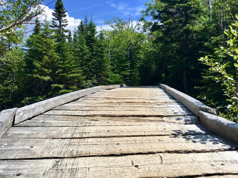
And once you reach the Chimney Pond Trail, the hiking eases up considerably, with flatter terrain and lovely bridges.
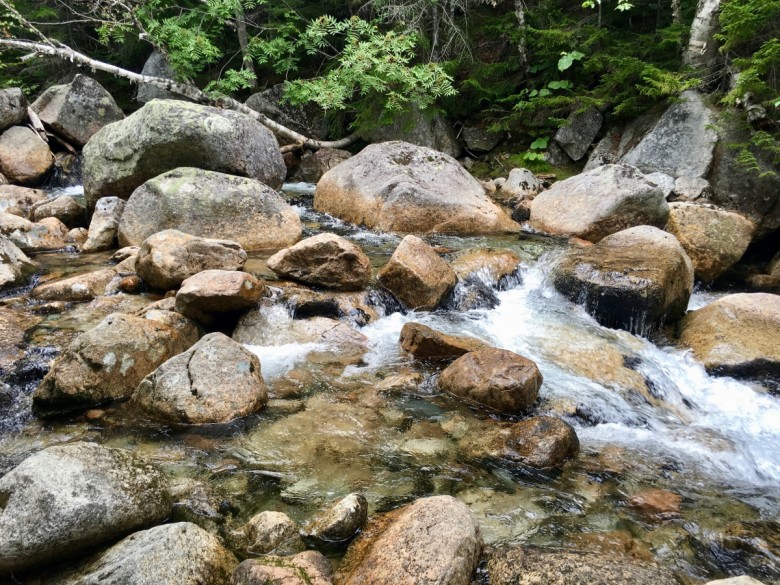
Be sure to take a moment to check out Roaring Brook, with its beautiful stones and boulders and incredibly clear water.
If You Go:
- Be prepared. Much of the Mount Katahdin hike is in maximum exposure and the weather can change quickly, so be sure to have at least two quarts of water, a working flashlight, durable hiking boots, rain gear and extra clothing, a detailed map, high-energy foods, and first-aid supplies.
- Plot out your itinerary ahead of time: Decide on your route, and make your Baxter State Park camping or parking reservations.
- Get an early start. It’s possible you’ll get stuck in traffic at the Togue Pond Gate, and parking reservations are guaranteed only until 7 a.m.
- Check the mountain’s weather on the day and the night before your trip, and talk to the ranger before leaving on your hike. He or she will have the best insight on the daily weather and trail conditions.
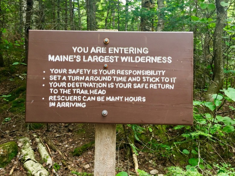
Photo Credit : Cathryn McCann
Lodging Options:
- Staying at one of the campgrounds in Baxter State Park will get you closest to the trails on the day of your hike.
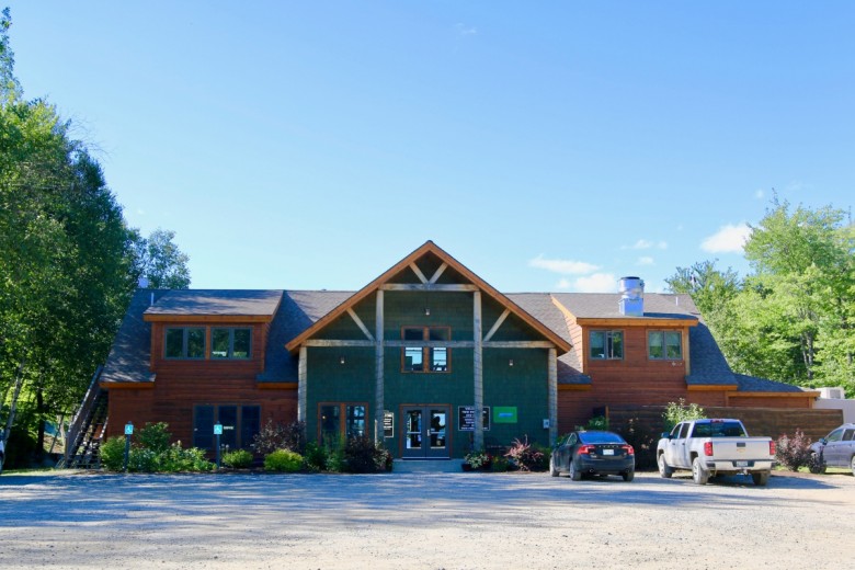
- The New England Outdoor Center is about a 45-minute drive from the park and offers a range of cabins and lodges to stay in, plus plenty of other outdoor activities and a view of Millinocket Lake and Mount Katahdin.
- In downtown Millinocket, about an hour away from the park, you’ll find a number of inns, cabins, lodges, camping, and bed-and-breakfasts.
Have you ever hiked Mount Katahdin? Tell us about it!
This post was first published in 2017 and has been updated.
SEE MORE:
Gulf Hagas, the Incredible ‘Grand Canyon of Maine’
Doing the Presidential Range Traverse in New Hampshire’s White Mountains
Franconia Ridge Loop | The Perfect White Mountains Hike
Cathryn McCann
As Digital Assistant Editor, Cathryn writes, manages, and promotes content for NewEngland.com and its social media channels. Prior to this role, she lived and worked on Martha’s Vineyard as a newspaper reporter, covering everything from environmental issues and education to crime and politics. Originally from New Hampshire, Cathryn spends most of her time out of the office on the trails, slopes, or by the water.
More by Cathryn McCann


