Unlike most National Parks and despite its proximity to the city, a visit to the Boston Harbor Islands can still feel like a secret escape.
By Steve Jermanok|Jun 29 2015|
Coffee By Design | Portland, Maine
Photo Credit : Katherine Keenan
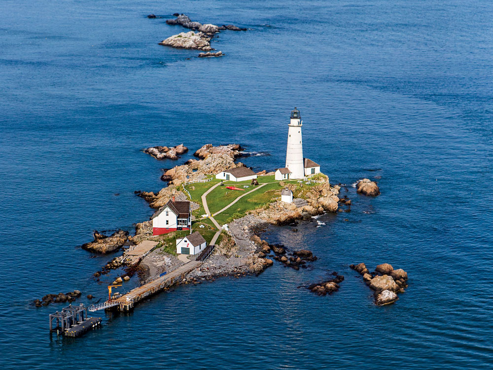
Little Brewster Island, at the eastern side of the National Recreation Area, is home to Boston Light, established in 1716, the oldest continuously operating light station in the U.S. The current tower dates to 1783. The Park Service offers a three-hour narrated cruise and tour. Photo Credit : Brian Wedge
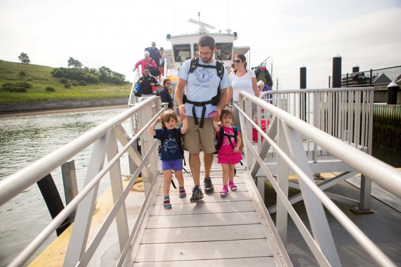
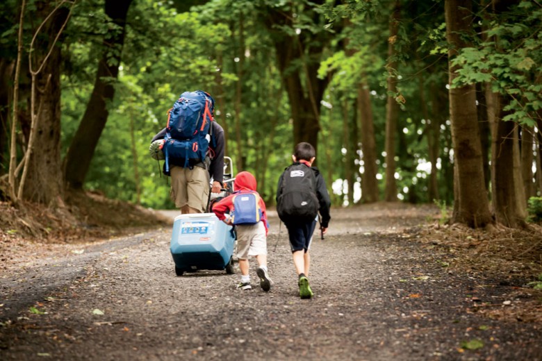
The summer morning was already hot by the time Captain John arrived at the Hingham docks in his small yellow boat. Couples, families, and a group of college students hauled their camping gear aboard the ferry, excited to spend a night or two in a peaceful setting, just a stone’s throw from urbanity. We passed large commuter ferries bringing their loads from the South Shore to the toils of work in downtown Boston, while we were headed in the opposite direction, toward Boston Harbor Islands National Recreation Area—to play, to breathe salty air, to relax our shoulders, and to smile, knowing that we’d made a wise choice.
“The setting was surreal: so close to the pulse of the city, yet adrift on an island, roasting marshmallows.” Photo Credit : Brian Wedge
Less than 15 minutes later, we arrived at Grape Island, our home for the day and night. A grassy trail led from rocky shores past vines of wild roses and sumac bushes to a handful of camping sites shaded by pines and tall birch trees. Unlike the other Boston Harbor Islands and their storied history of housing forts, hospitals, casinos, and barracks, 54-acre Grape has been used only for agriculture and thus retains a genuine wilderness feel. After putting up our tent, I took a short walk along a trail atop a knoll, which rewarded me with vistas of the harbor. Then I turned around … and I could almost touch the big buck and his massive rack. He looked at me, uninterested, and continued to feed on blueberries while I walked away, delighted with the unexpected encounter.
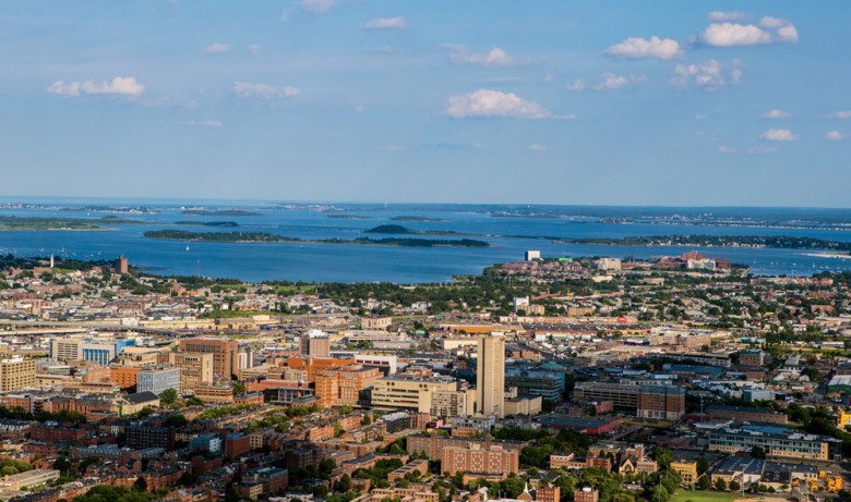
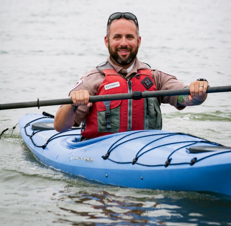
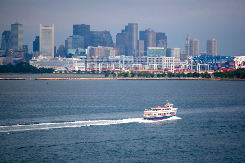
Massachusetts Conservation & Recreation ranger Corey Schiller kayaks between islands. Photo Credit : Brian WedgeA view of the Boston skyline from the harbor. Photo Credit : Brian WedgeDay visitors disembark on Spectacle Island, which was reshaped using soil excavated during the city’s Big Dig. Photo Credit : Brian Wedge
Boston Harbor has made a remarkable turnaround since the 1988 presidential race, when then–Vice President George Bush ran an ad that blamed Massachusetts governor Michael Dukakis for dumping “500 million gallons of barely treated sewage” into the water each day. Unfortunately, Bush’s assessment of conditions was correct. Ever since Europeans colonized the region in the early 1600s, residents had been dumping waste into the harbor. By 1988, a decades-old waste-treatment plant on Deer Island was still dumping millions of gallons of sewage, 25 percent of it untreated, into the water. The result was that most city beaches were closed for at least half the summer.
A federal court mandated that Boston clean up its harbor by 2000, funded by a multibillion-dollar public-works project. A state-of-the-art treatment facility was built on Deer Island, resulting in plummeting pollution levels and a restored, even replenished, ecosystem. Seals, porpoises, and fish returned in great numbers; beaches, staffed by lifeguards, are now open all summer. In November 1996, Congress passed legislation that made Boston’s watery front yard a part of the National Park system. Yet, unlike most national parks, the Boston Harbor Islands still feel underutilized. Each year only about 130,000 visitors arrive on their shores via ferries.
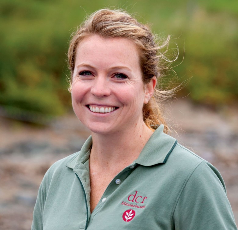
“Although not everyone in New England knows about the islands, word is slowly catching on,” notes Jessica Renehan, park coordinator at the Massachusetts Department of Conservation & Recreation, Islands District. One of the major deterrents is accessibility. Only six of the 34 islands can now be reached by ferry. If you want to visit one of Renehan’s favorite islands, Calf, you’ll need your own boat. For folks who make the effort to sample one of the islands, however, it’s like turning over a rock to uncover a purple starfish: a surprising blend of Civil War–era forts, centuries-old lighthouses, drumlins, and rugged shoreline, guaranteed to entice the budding historian or those of us who yearn for a slice of solitude.
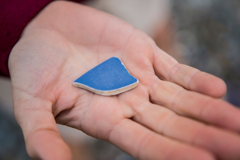
A tranquil summer island vista as seen from the ferry as it heads back to Hingham. Photo Credit : Brian WedgeA ranger holds of shard of sea glass found on Spectacle Island. You can’t take your beachcombing finds home with you, but you’re welcome to leave them for display at the island visitors’ center. Photo Credit : Brian WedgeA collection of “sea marbles,” bits of pottery and glass weathered by saltwater. You can’t take your beachcombing finds home with you, but you’re welcome to leave them for display at the island visitors’ center. Photo Credit : Brian Wedge
“I’ve been living in the Boston area for 20 years and I’ve never been out here? Why?” says Arlington’s Chris Scypinski, echoing the thoughts of many. We’d just returned from an hour-long sea-kayaking jaunt led by Grape Island ranger Nick Ferry. He guided us across a short channel and then circumnavigated neighboring Slate Island, lined with seagrass and striated rock. Nick stopped to pick up an innocuous cup jellyfish, and, on the opposite shore, pointed out a common eider, the bird’s head crowned black like some superhero of the duck world.
We returned to our campsite to dine on curried chicken salad and coleslaw, then wandered over to the back of the island to light a bonfire on the beach and watch the sun set over the Boston skyline. As waves rolled ashore and the splintering of kindling could be heard and seen down the shoreline, the Prudential Building was bathed in a reddish-pink glow. The setting was surreal: so close to the pulse of the city, yet adrift on an island, roasting marshmallows.
On Georges Island, many of Fort Warren’s original buildings and defensive structures remain. Photo Credit : Brian Wedge
That night, I slept peacefully in the cooler air, listening to the sound of foghorns moaning in the distance. I awoke to seagulls squawking and the sun rising over Slate Island, as the first lobstermen headed out into the harbor’s calm waters. I looked up to see the morning flights leaving Logan Airport and sat on a grassy patch under a weeping willow; judging from its expansive web of branches, I figured it must have been rooting here since the Wright brothers’ first flight. After a sumptuous breakfast of homemade banana bread and fresh peaches, we cleared our campsite and waited for Captain John to pick us up again.
—
Another bright, sunny day ideally suited for exploring four additional Boston Harbor Islands. First stop was Bumpkin, where some of the trails were paved, a result of a children’s hospital that once stood here at the turn of last century. During World War I, 56 additional buildings were erected on the island to house some 1,300 sailors. You can see the crumbling remains of the buildings, along with a stone farmhouse that was built in the latter part of the 19th century. Most of the drumlin is now overgrown with regenerated forest, with yellow warblers escorting us around the island to a barrier beach extending almost to the mainland.
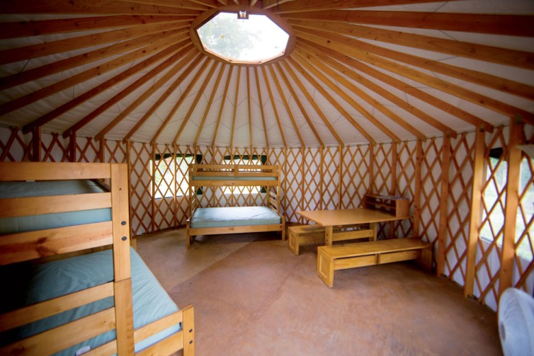
Peddocks is one of four islands where overnight camping is permitted. Photo Credit : Brian WedgeEach of the island’s yurts is furnished with bunkbeds (bring pillows and sleeping bags), a table with benches, lighting, and an electrical outlet. Photo Credit : Brian Wedge
More than twice the size of Bumpkin, Peddocks Island was once home to Fort Andrews, a World Wars I and II training facility. You can walk around the numerous boarded-up barracks, play a game of croquet on the parade ground, or take a stroll high above the East Head cliffs to look down at “the Gut,” a nasty current between the island and the town of Hull that wreaks havoc on sea kayakers who try to paddle across.
Spectacle and Georges islands are the two main hubs of the Boston Harbor Islands. Spectacle had its heyday in the 1840s as a casino and upscale resort. In 1857, the property was closed when police discovered a brothel on the island. In the 20th century, Spectacle was simply a dumping ground for Boston’s garbage. It would have remained an eyesore if it hadn’t been for the shrewd idea to take the 6.3 million tons of excavated dirt unearthed during Boston’s Big Dig and use it to reshape the island, providing topsoil for more than 2,400 trees. Now Spectacle boasts the highest point on the Eastern Seaboard south of Maine and more than five miles of trails that lead walkers down to the beach.
Spectacle Island is home to a marina, visitor center, café, swimming beach, and trails that lead to panoramic views. Photo Credit : Brian Wedge
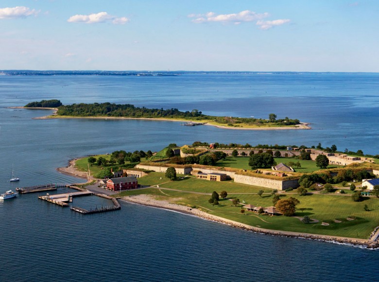
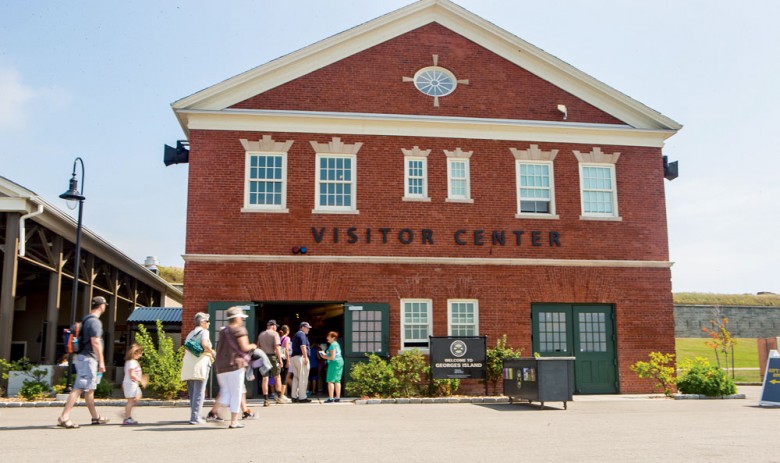
Georges Island, our final stop, has an equally alluring history. Construction of Fort Warren was started in 1833 to defend the United States against a possible invasion. However, it wasn’t until the Civil War that Georges gained notoriety as a training ground for Union troops and the site of a prison camp for more than 2,000 Confederate soldiers; the vice president of the Confederacy, Alexander Stephens, was also interned here. We arrived on its shores to find a relatively new Visitors’ Center adjacent to an outdoor patio eatery serving clam chowder, lobster rolls, burgers, and other casual fare from Boston’s beloved Summer Shack restaurant.
Georges Island is the harbor transportation center. Photo Credit : Brian Wedge
We were met by former ranger Jerry McCormack, dressed in the garb of a Union army sergeant, about to lead a small group on a guided tour of the fort. McCormack’s father was foreman on this island for 26 years, so he has fond memories of growing up here. “Every year on Halloween, we held a haunted house, where my role was to crawl into the large bread ovens,” McCormack says with a laugh. “Then they’d pull me out wincing and screaming and say, ‘Nope, he’s not done yet!’”
Jessica Renehan, park coordinator with the Commonwealth’s Department of Conservation & Recreation. Photo Credit : Brian Wedge
To enter this impregnable defense system, you walk across a moat on a drawbridge and slip through an iron gate leading to a parade ground more than two football fields long. All of the hand-cut granite and brickwork is original. High-ranking Confederate officers were housed in spacious cells, each equipped with a chandelier, a fireplace, and rooms for servants. Despite the bitterness of the war, the Union was also kind enough to allow the visiting families of Confederate officers to stay with them inside the prison.
Taking the steps up to the ramparts, you can peer down at the stately horse-chestnut trees lining the grounds. But most visitors will be gazing out to sea to view the white edifice that stands tall on Little Brewster Island. Dating from 1783, Boston Light is the oldest continuously manned lighthouse in America. Beyond it you can just make out the gray form of Graves Light, rising at the head of the Boston Harbor entrance, nine miles from the city. A private owner purchased the lighthouse in 2013 for $933,000, renovating it both to create a family retreat and to preserve a historic landmark.
Far more affordable is a night camping on Grape Island, where you can watch the never-to-be-forgotten sight of the sun rising over the Atlantic and setting over the Boston skyline.
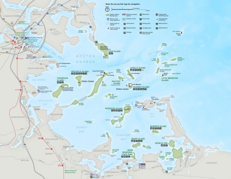
BOSTON HARBOR ISLANDS | GETTING THERE Map of the Boston Harbor Islands. Photo Credit : Courtesy of the National Park Service
Ferries operate from May to October from Long Wharf North in Boston and in July and August from Hingham Shipyard in Hingham and Pemberton Point in Hull. Inter-island ferries connect Georges and Spectacle to Grape, Bumpkin, Peddocks, and Lovells.
Boston Light is open for ranger-led tours from late June to October. For schedules and fares: 617-223-8666; BostonHarborIslands.org
Rangers lead tours on eight of the islands: Bumpkin, Georges, Grape, Little Brewster, Lovells, Peddocks, Spectacle, Thompson.
Camping is allowed on Grape, Peddocks, Lovells, and Bumpkin. Only Peddocks has fresh water and electricity. Book your site: 866-422-6762; reserveamerica.com
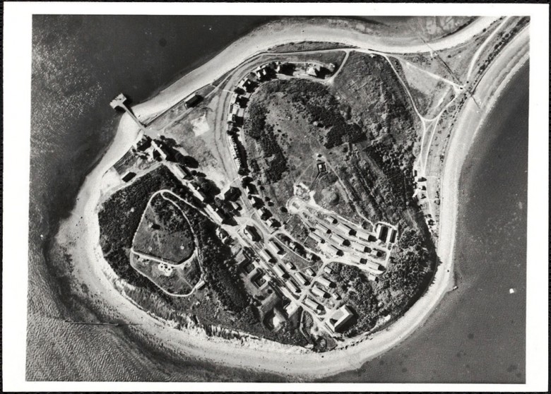
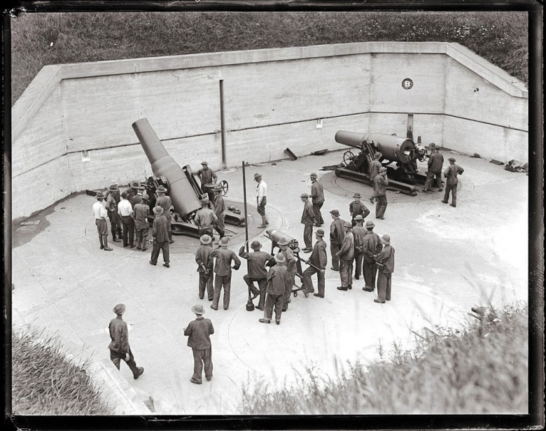
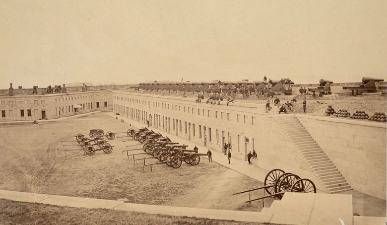
Download a printable page-size PDF of the map at left: nps.gov/hfc/carto/PDF/BOHAmap1.pdfBOSTON HARBOR ISLANDS | A LOOK BACKA classroom on Long Island at the turn of the 20th century. Over the years, the island saw many uses: It was the site of a conscript camp during the Civil War; later, resort and fishing communities were established on the island. An almshouse, a hospital, and a nursing school also once functioned here. Most recently it was home to various city social services; today there is no longer any access to the island, as the bridge has been dismantled. Photo Credit : Courtesy of the Trustees of the Boston Public LibraryThis 1944 aerial view of Peddocks Island shows Fort Andrews, active in harbor defense from 1904 through the end of World War II. Several structures remain, including a gym, a firehouse, stables, a POW barracks, and more, though today most are closed to the public. Photo Credit : Courtesy of the Trustees of the Boston Public LibraryIn this pre–World War II shot on Peddocks Island by Boston Herald Traveler photographer Leslie Jones, soldiers at Battery Frank Whitman are gathered around the facility’s 12-inch mortars. The fortification was named for a Kansas army major who had served in the Spanish–American War. Photo Credit : Courtesy of the Trustees of the Boston Public LibraryA Civil War–era image shows the interior of Fort Warren on Georges Island. The federal government acquired Georges Island in 1825 and built massive fortifications there; by the time Fort Warren was dedicated in 1847, it had already been surpassed by newer military designs, but was used as a training site. During the Civil War, a prison here housed Confederate troops—as well as the Confederate VP, Alexander Stephens. Photo Credit : Courtesy of the Trustees of the Boston Public LibrarySEE MORE:Boston Harbor Islands | Photographs
Don’t try to do too much on your first visit.I think a day at George’s Island is a good way to start,then plan other trips with the knowledge you’ve gained. Be prepared for bumblebees and lots of goose poop though.
I was a D.C.R. Ranger 2012 on Georges Island.and went on Gerry’s tour. He told the story of the boy in the oven, my favorite tale, that today as a volunteer I tell that story to all the visitors that I encounter.